Enterprise LiDAR Survey Kit
From: $40,798.00
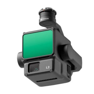
Combine the DJI Matrice 350 RTK, the DJI Zenmuse L2 and the Emlid Reach RS2+ GNSS RTK receiver to implement enterprise-grade LiDAR survey workflows that adapt to every job condition:
– RTK survey: Use the Reach RS2+ to coordinate your own RTK base station and send RTK corrections to the Matrice 350 RTK, via remote or local NTRIP mount points. All LiDAR/RGB datasets captured with the Zenmuse L2 sensor will be saved with centimetre-accurate coordinates. Lastly, use DJI Terra Pro to post-process the datasets with increased accuracy and export point clouds in popular file formats.
– PPK survey: The Reach RS2+ collects RINEX observation files, necessary in a PPK workflow. That reduces the dependency on third-party CORS services, particularly on remote areas. Back into the office, post-process the Zenmuse L2 and Reach RS2+ datasets with DJI Terra Pro and export high-accuracy point clouds.