Emlid Flow 1-Year Survey Plan Subscription

$375.00

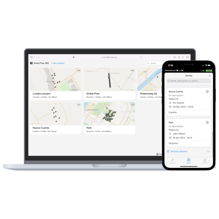
The Emlid Flow Survey Plan Subscription unlocks advanced survey functions on both the Emlid Flow app and the Emlid Flow 360 cloud-based interface.

See added benefits below:

Emlid Flow

– Collect and stakeout lines
– Add survey codes on the go
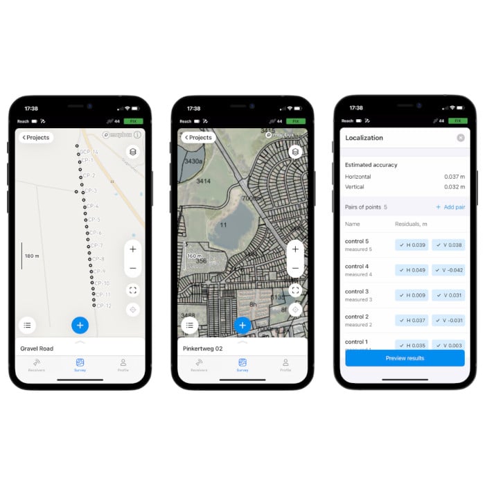
– Use WMS/WMTS layers
– Satellite map
– Localization

Emlid Flow 360

– Upload code libraries
– Satellite map
– Use WMS/WMTS layers

Up to three Emlid Flow 1-Year Survey Plan Subscription licenses can be active simultaneously on your Emlid Flow account, ensuring you have long term access to the benefits of the Survey Plan.

FREQUENTLY BOUGHT TOGETHER

Emlid Reach RS2+

RS2+ RTK GNSS RECEIVER WITH LTE MODEM AND CENTIMETRE PRECISION

The latest RS2+ features an LTE Modem, dual diversity LTE antennas and a range of design improvements to deliver Emlid’s most user-friendly and durable GNSS receiver yet. The Reach RS2+ is a versatile GNSS receiver that can be used for surveying, mapping, and navigation. It offers centimetre-level accuracy in both RTK and PPK mode, has a battery life of up to 22 hours and is engineered to be tough.

The Emlid Flow mobile app enables you to control the RS2+ receivers with iOS and Android devices.

GNSS

GPS/QZSS L1C/A, L2C
GLONASS L1OF, L2OF
BeiDou B1I, B2I
Galileo E1-B/C, E5b

Positioning Accuracy

PPK
Horizontal 5mm + 0.5 ppm
Vertical 10mm + 1 ppm

RTK
Horizontal 7mm + 1 ppm
Vertical 14mm + 1 ppm

Connectivity

LoRa radio 868/915MHz (up to 8Km)
Built-in LTE modem (Nano-SIM)
Wi-Fi 802.11b/g/n
Bluetooth 4.0/2.1 EDR
Ports: RS-232, USB Type-C

Data

NTRIP and RTCM3 corrections
NMEA and LLH/XYZ position output
RINEX logs with update rate up to 20Hz
16GB internal storage

Package Contents

– Emlid Reach RS2+
– LoRa antenna
– USB cable
– Carrying case
Emlid Flow app (free download)

Emlid Reach RX

NETWORK ROVER WITH CENTIMETER ACCURACY

Pocket-sized and lightweight rover for data collection with centimeter accuracy. Works with network corrections (NTRIP). Comes with the Emlid Flow app.

The Emlid Flow mobile app enables you to control Emlid Reach receivers with iOS and Android devices.

GNSS

GPS/QZSS L1C/A, L2C
GLONASS L1OF, L2OF
BeiDou B1I, B2I
Galileo E1-B/C, E5b

Positioning

RTK
Horizontal 7mm + 1 ppm
Vertical 14mm + 1 ppm

Convergence time
~5s typically

Connectivity

Bluetooth 4.2
USB Type-C

Data

Input data format: RTCM3
Input data protocol: NTRIP
Position data format: NMEA

Package Contents

– Emlid Reach RX
– USB Type-C cable
– Emlid Flow app (free download)

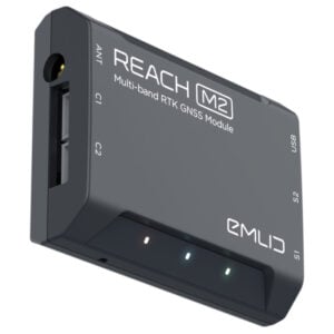
Emlid Reach M2

MULTI-BAND RTK GNSS MODULE FOR PRECISE NAVIGATION AND UAV MAPPING

For precise UAV mapping with less GCPs.

The Reach M2 is a compact and easy-to-use RTK GNSS module that connects to a camera and records the location of each photo. With an update rate of up to 20 Hz, the Reach M2 produces highly detailed and accurate georeferenced data sets.

GNSS

GPS/QZSS L1C/A, L2C
GLONASS L1OF, L2OF
BeiDou B1I, B2I
Galileo E1-B/C, E5b

Positioning Accuracy

Static horizontal 4mm + 0.5 ppm
Static vertical 8mm + 1 ppm

Kinematic horizontal 7mm + 1 ppm
Kinematic vertical 14mm + 1 ppm

Connectivity

LoRa radio (sold separately) 868/915MHz (up to 8km)
Wi-Fi 802.11b/g/n
Bluetooth 4.0/2.1 EDR
Ports: USB, UART, Event

Data

NTRIP and RTCM3 corrections
NMEA and LLH/XYZ position output
RINEX logs with update rate up to 20Hz
16GB internal storage

Package Contents

– Emlid Reach M2
– Micro-USB cable
– JST-GH 6-pin to jumper pin cable
– JST-GH 5-pin to jumper pin cable
– Emlid Flow app (free download)

Categories: , Tag:

Description

The Emlid Flow Survey Plan Subscription adds the following advanced survey features to the base Emlid Flow app and the Emlid Flow 360 cloud-based interface:

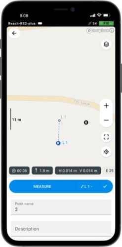
Linework data collection

Measure and move ahead with just a few taps. You can use either predefined geometry types or a full-blown code library, whatever suits your needs.
Emlid Flow

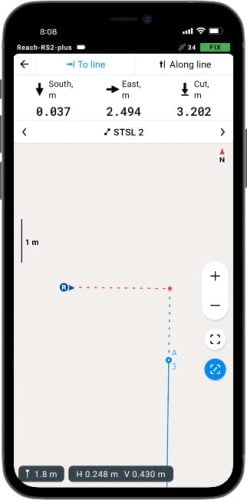
Line stakeout

With Emlid Flow visual guides, you can perform stakeout with an offset. The distance along the line indication will help you stake out with chainage.
Emlid Flow

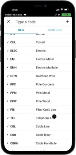
Code library

Upload your custom code library or use a standard one built into Emlid Flow with more than a hundred codes available from the start.
Emlid Flow

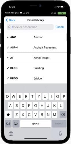
Add codes on the go

No survey library is perfect, so you can always create new codes on the go
right in your survey project.
Emlid Flow

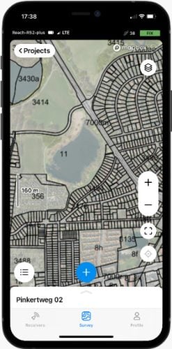
Different background maps

Upload topographic maps, cadastral plans, and aerial imagery from WMS and WMTS sources or work with a built-in satellite map.
Emlid Flow

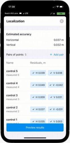
Localisation

Adjust your coordinate system to fit the control points. All residuals are placed on a single screen, so you have the full context while you adjust.
Emlid Flow

Resources

webpage

User Manual

Emlid Flow Documentation

webpage

Tutorial

Emlid Flow License Activation