Description
Any GNSS-device enabled
HxGN SmartNet is an open-standard correction service, able to use with any GNSS device, and is constantly monitored for integrity, availability and accuracy.
World's largest reference station network
HxGN SmartNet is the GNSS correction service built on the world’s largest reference station network, enabling GNSS-capable devices to quickly determine precise positions even down to the centimetre.
Continuous availability
HxGN SmartNet is provided 24/7 by a highly-available infrastructure and professional support team with more than 10 years of experience reliably delivering the service.
Trusted technology
With more than 4,500 reference stations based on Leica Geosystems technology that ensure position accuracy in any application, HxGN SmartNet is easy to use and provides the fastest precise positions.
Coverage in Australia
Application
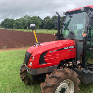
Precision Farming
More crops. Fewer strikes. Reduced costs. Less tiring work. Tractor operations are automated with the precise positioning of HxGN SmartNet. Farmers can produce higher yields per day with less effort.
How it works
GNSS users can simplify their workflows to arrive at an accurate position by substituting single reference stations for local RTK networks. Many problems, such as limited availability and communication issues, are solved and productivity is increased.
The need of accuracy for agriculture and machine control have been the main drivers for innovation.
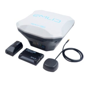
Today, HxGN SmartNet has perfected this innovation. Receive high precision correction data in an open standard format (RTCM) simply by connecting any GNSS-enabled devices over the mobile internet. This correction data are used on the GNSS device to enhance its autonomous position even down to a centimetre. This precise position can be used afterwards on the application of devices, assets and machines. On the device or even in the cloud, the value of the application is enhanced.