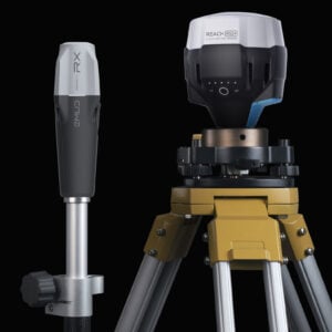
Description
Easy to set up: just add NTRIP
Reach RX uses Bluetooth Low Energy (BLE) that allows you to connect and start surveying with your smartphone or tablet in a few seconds. Enable Bluetooth on your iOS or Android device, find your Reach RX in Emlid Flow, add network correction credentials, and collect your first point. No setting to get wrong.
Centimeter accurate results
Reach RX tracks GPS/QZSS, Galileo, Glonass, and Beidou and gets a fix in under 5 seconds even in challenging conditions.
Pocket-sized and lightweight
The weight of Reach RX is just 250 grams. Take it anywhere—it weighs less than a can of soda and fits in any glove compartment or a backpack pocket.
No need for special training
With Reach RX, you can forget about spending time on in-person training and courses. Reach RX is designed to meet the expectations of both experienced professionals and non-surveyors who need to get highly-accurate results. Now anyone on the team can start using RTK.
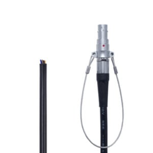
Compact and rugged
250 grams
172 mm x 51 mm x 51 mm
Weight like a TV remote controller and able to be carried in your pocket.
IP68
RX is waterproof up to 1.5 m depth. All connectors are completely sealed and protected from water and dust with silicone plugs.
-20 to +65 °C
We extensively tested Reach RX in conditions that simulate the coldest winters and hottest summers.
Industrial battery
Li-Ion battery
Industrial battery that handles both high and low temperatures well.
16 hours of work
2 days of work for less than 3 hours of charging. You can charge on-the-go from any USB port and power bank with the cable that comes with Reach RX.
2000+ cycles
of charging and discharging while maintaining original capacity.
Surveying with Emlid Flow
The Reach RX comes with the Emlid Flow app, providing an easy to use data collection mobile app solution for both Android and iOS. With Emlid Flow, you can collect and stakeout points and control all the features of Reach receivers, such as setting up a base station, logging RINEX data, and configuring NMEA output.
Point collection
Record centimeter-precise coordinates for each point.
Export and import data in the CSV, DXF, and Shapefile formats used by CAD, GIS, and most other professional survey software.
Share collected data using WhatsApp, Drive, Mail, or any other file-sharing app on your phone.
STAKEOUT
Stakeout is used to find exact physical locations of points. They can be collected in Emlid Flow or imported from other CAD or GIS software.
Coordinate Systems
WGS84, NAD83, GDA94, GDA2020, and others
EXPORT
With Emlid Flow you can save points, export data in several different file formats (CSV, DXF and ShapeFile), and share it using your mobile device.
Download the app
 |  |