Description


$2,610.00 – $7,450.00
![]()
Capture, analyze and visualize your environment with DJI Terra – an easy to use mapping software developed to help industry professionals transform real-world scenarios into digital assets.
– Model reconstruction: Import images to generate a high-resolution 2D orthophoto map and a high-accuracy 3D model
– Real-time reconstruction (Phantom 4 Series only): Generate a 2D orthophoto map and a 3D model in real time during the flight to output results as you fly
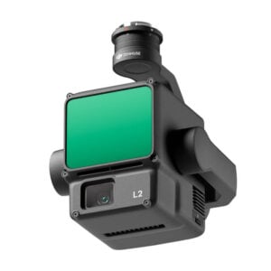
– Lidar data processing: Working with DJI Zenmuse L2 (or a DJI Zenmuse L1) and DJI Terra can generate high-accuracy true-color cloud points with one click.
– Detailed inspection (DJI Matrice 350 RTK, DJI Matrice 300 RTK and Phantom 4 RTK only): Automatically generate routes based on target points marked in a 3D model or point cloud to automate inspection workflows
– Model application: Easily measure target coordinates, distances, areas, volumes, and other key data and rename or export the data results
– Microsoft Windows 7 or later (64-bit)
– At least 16 GB of memory
– NVIDIA graphics card with a compute capability of 3.0 or above
DJI Terra licenses are activated and sent to you in up to three business days from the payment date.