Description
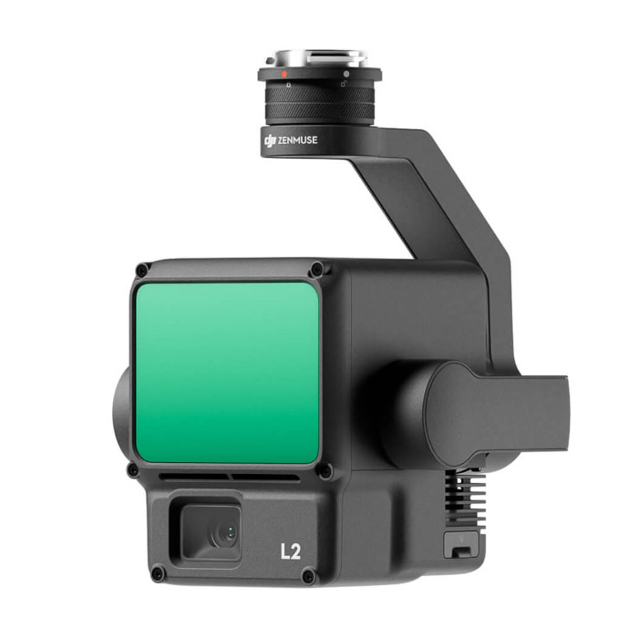 DJI Zenmuse L2 | 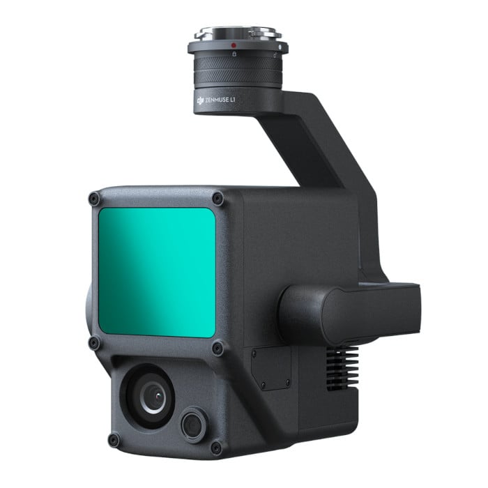 DJI Zenmuse L1 | |
|---|---|---|
| Detection Range | 450 m @ 50% reflectivity, 0 klx 250 m @ 10% reflectivity, 100 klx | 450 m @ 80% reflectivity, 0 klx 190 m @ 10% reflectivity, 100 klx |
| Number of Returns | Up to 5 | Up to 3 |
| Point Cloud Rate | Single Return: 240,000 pts/s Multiple Return: 1,200,000 pts/s | Single Return: 240,000 pts/s Multiple Return: 480,000 pts/s |
| Position Accuracy (RMS 1σ) | 5 cm horizontal; 4 cm vertical @ 150m | 10 cm horizontal; 5 cm vertical @ 50m |
| Ranging Accuracy | 2 cm @ 150 m | 3 cm @ 100 m |
| Scanning Modes | Repetitive, Non-Repetitive | Repetitive, Non-Repetitive |
| Field of View | 70°×3° (Repetitive Scan) 70°×75° (Non-Repetitive) | 70.4°×4.5° (Repetitive Scan) 70.4°×77.2° (Non-Repetitive) |
| Laser Spot Size | 4 cm horizontal, 12 cm vertical @ 100 m (FWHM) | 5 cm horizontal, 50 cm vertical @ 100 m (FWHM) |
| IMU Warm-Up | Not required | 5-minute warm-up required before each flight |
| Yaw Accuracy (RMS 1σ) | 0.2° (real-time) 0.05° (post-processing) | 0.3° (real-time) 0.15° (post-processing) |
| Pitch/Roll Accuracy (RMS 1σ) | 0.05° (real-time) 0.025° (post-processing) | 0.05° (real-time) 0.025° (post-processing) |
| RGB Camera Sensor Size | 4/3 CMOS | 1 inch |
| RGB Camera Effective Pixels | 20 MP | 20 MP |
| Dimensions/Weight | 155 × 128 × 176 mm / 905 ± 5 g | 152 × 110 × 169 mm / 930 g |
| IP Rating | IP54 | IP54 |
| Operating Temperature | -20°C to 50°C | -20°C to 50°C |
| Compatibility | DJI Matrice 350 RTK DJI Matrice 300 RTK |