Description
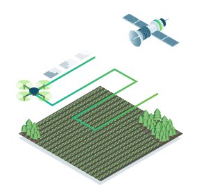
Create precision agriculture maps using images from drones and satellite
Remote sensing
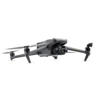
Collect images using a drone and any standard RGB or select multispectral cameras. You can also use Satellite Data Import to enhance your mapping experience with Sentinel-2 satellite data.

Process
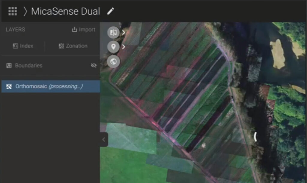
Process imagery with the instant processing engine and get your maps directly in the field: 6.8 GB, 2948 images, 10 min (with the new radiometry module).
Scout
Generate precise orthomosaics, digital surface models, index maps, zones and accurate prescription maps. Trim your fields to a desired field boundary to create more targeted outputs.

Analyse
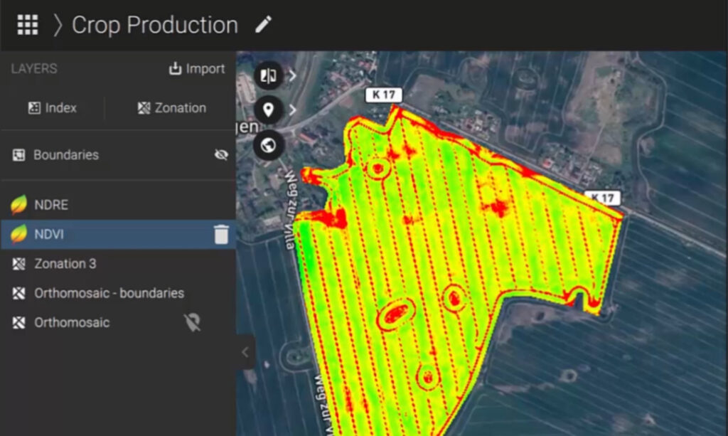
Visualize and understand your crop growth stages and stress levels. Analyse and compare different layers of information for a full insight of your yield performance and use them to increase crop production and reduce costs.
Integrate
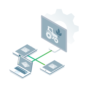
Download all outputs, results and insights and import them into the Farming Management Software of your choice in various industry standard formats.
The only hybrid mapping software solution for agriculture based on knowledge from farmers, agronomists, and researchers.
In-Field Results
Create maps rapidly (no internet connection required) for faster decision making and action, without leaving the field.
Accurate maps
Get maps of your fields and crops at any stage using satellite and/or drone imagery.
Trusted Results
Eliminate guesswork by analysing crop health maps and measure issues using calibrated multispectral or full resolution RGB images.
Easy Sharing
Share your data via PIX4Dcloud, as PDF report and in industry standard formats.
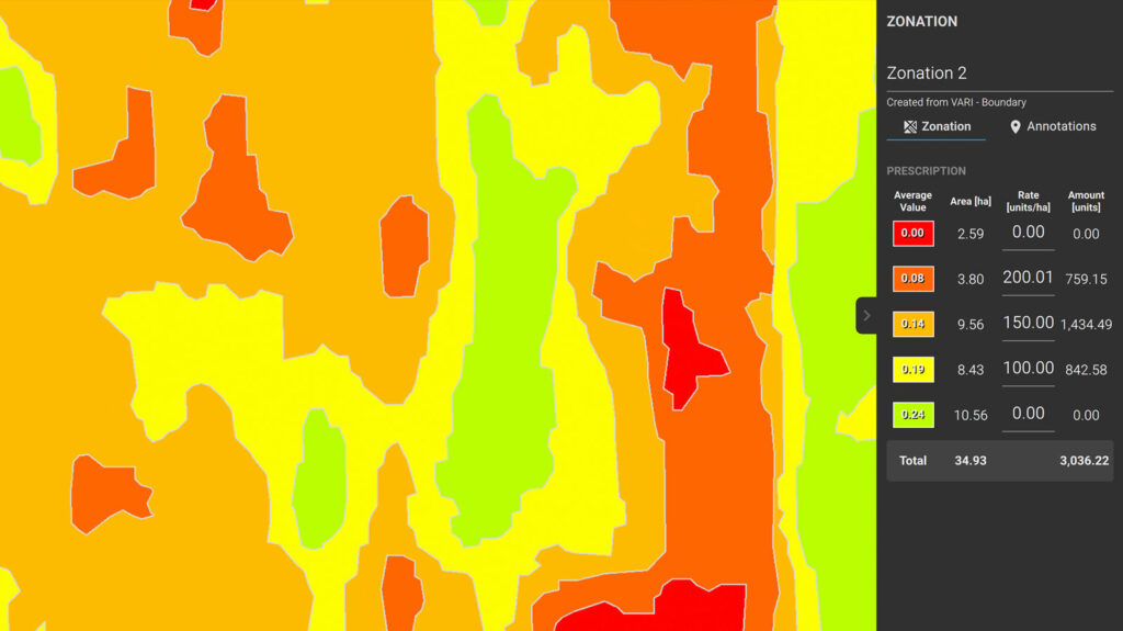
Use PIX4Dfields to create prescription maps and maximize crop yields
Get customizable variable rate and spot spraying maps for spray drones, tractors, and field sprayers.
Inspect, analyse and visualize your crop changes all year round
Fast processing - Accurate processing
Process imagery with the PIX4Dfields instant processing engine and achieve results in minutes in-office and in-field. No internet required.
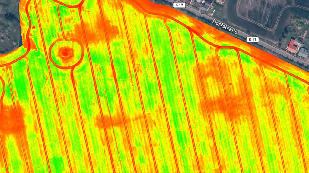
Generate indices
Use the predefined list of agricultural indices or input your own custom index formula to understand your plant stress better.
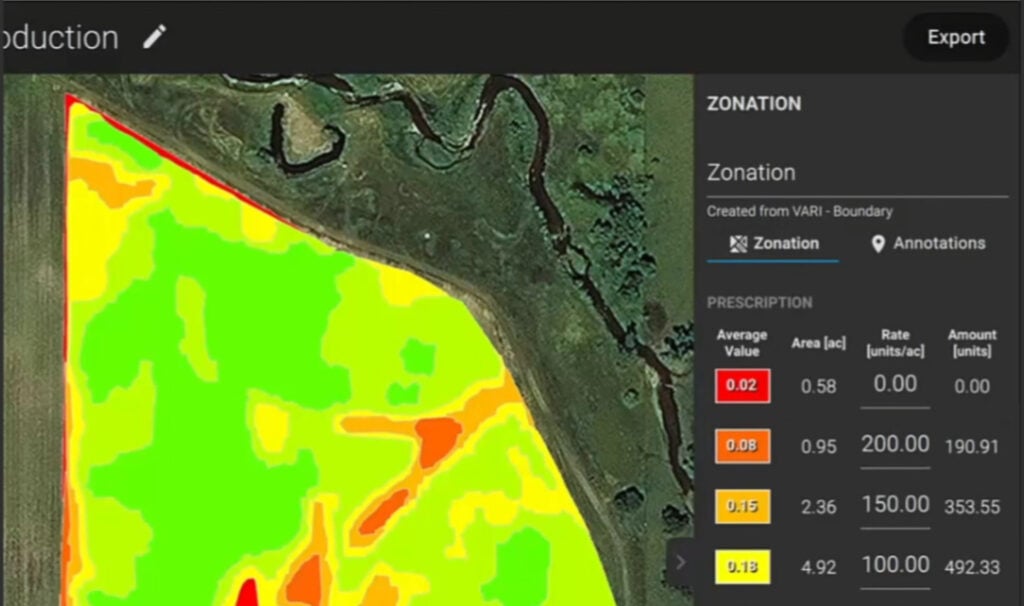
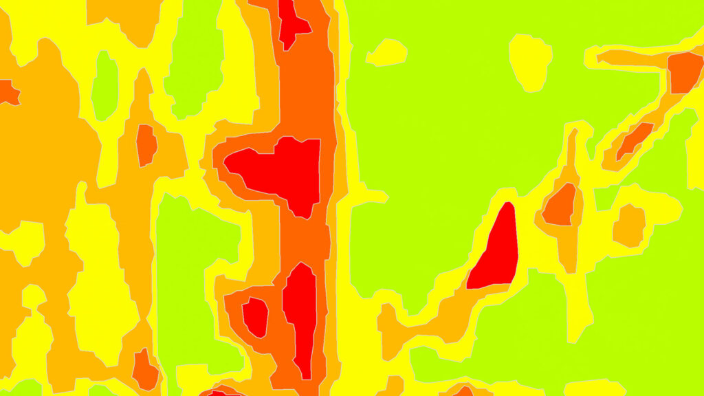
Zonate and prescribe
Aggregate the information from the vegetation index maps into zones and assign application rates.
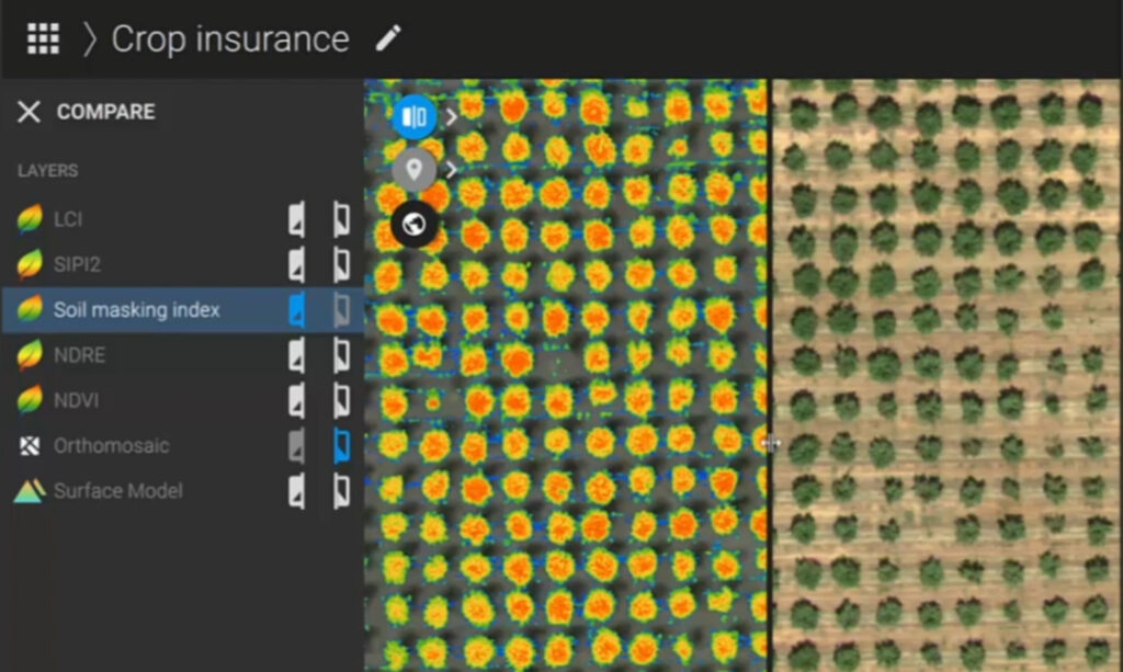
Compare
Link different layers of information and compare your crop trends over time in a split or a double screen.
Easily scout your farm and generate the appropriate output for your needs
Create and analyze real time maps of your crops to enhance your agriculture workflow
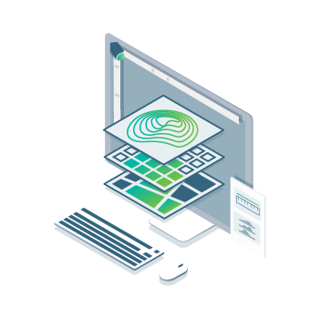
Orthomosaic
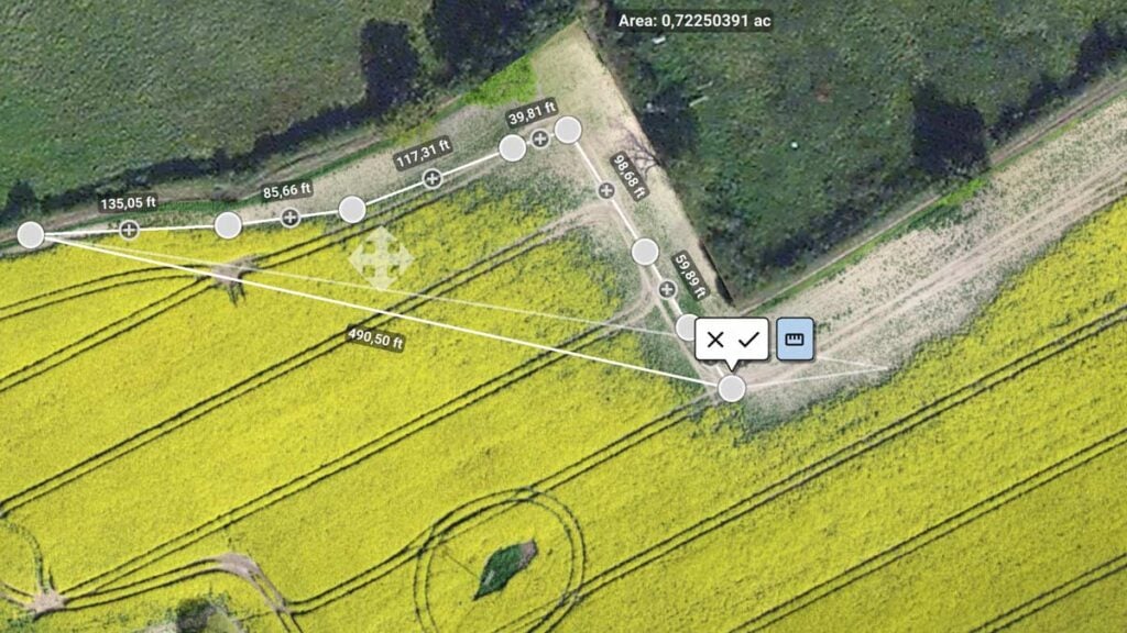
Field boundaries
Vegetation index map
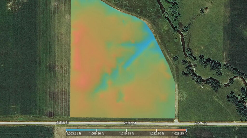
Digital surface model
Zonation map
Prescription map
Recommended system requirements
- Windows 10 (64 Bit) or above, macOS Big Sur (11.0) or above
- Quad-core or hexa-core Intel i5 (or faster)
- 16GB RAM (or more)
- SSD recommended
- Integrated or dedicated GPU with 2 GB RAM (GeForce GTX with 6GB RAM recommended)
Resources
Knowledge Base
PIX4Dfields Brochure
Knowledge Base
PIX4Dfields Feature List

Knowledge Base
Pix4D Webinars and eBooks
Support
PIX4Dfields Online Documentation
Software
PIX4Dfields Download