Description
Photogrammetry solution to power applications across industries
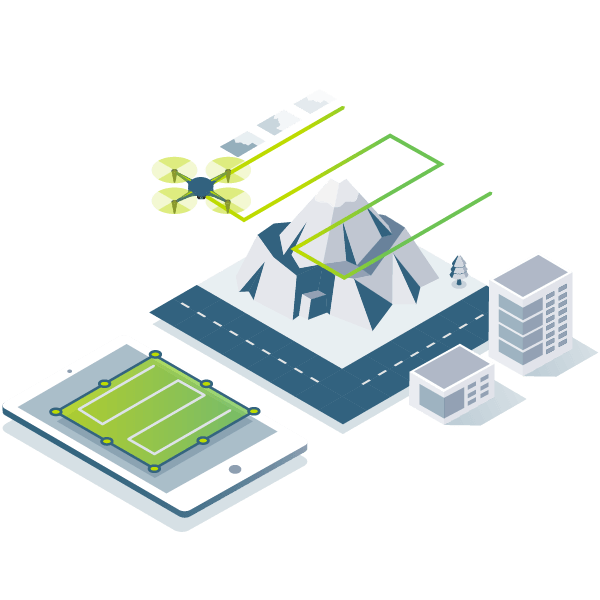
Capture
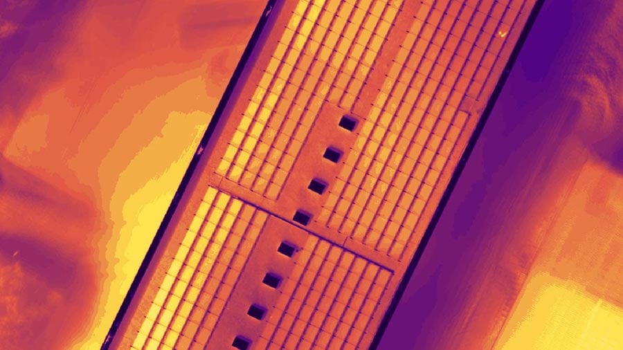
Capture RGB, thermal, or multispectral images with any camera or drone and import them to PIX4Dmapper.

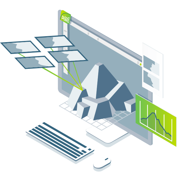
Digitise
PIX4Dmapper’s photogrammetry algorithms transform your ground or aerial images in digital maps and 3D models.
Control
Use the power of photogrammetry in the rayCloud environment to assess, control and improve the quality of your projects.

Measure and inspect
Accurately measure distances, areas, and volumes.

Collaborate and share
Selectively and securely share project data and insights, with your team, clients, and suppliers, using standard file formats.
Advanced data processing for precise results
Survey-grade results
Obtain results with sub-centimetre accuracy thanks to photogrammetric analysis. 1-2 pixel GSD in X, Y directions 1-3 pixels GSD in the Z direction
Complete control over your project
Define an area of interest, select processing options, add ground control points or edit point clouds, DSMs, meshes, and orthomosaics.
Your workflow, your choice
Use default templates for automatic processing of your projects, or create your own with custom settings for full control over the data and quality.
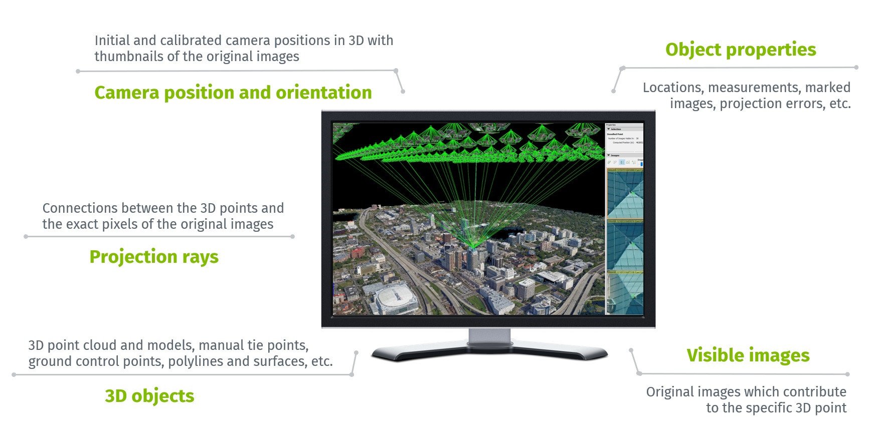
rayCloudtm - The power of photogrammetry software
A unique environment connecting your original images to each point of the 3D reconstruction to visually verify and improve the accuracy of your project.
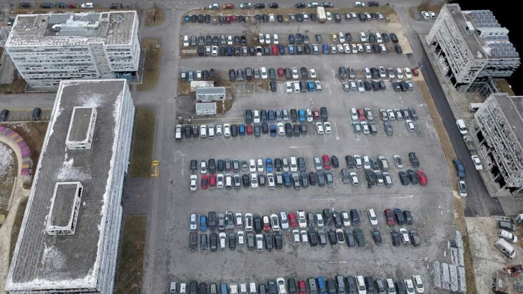
Accurate 3D maps and models, purely from images
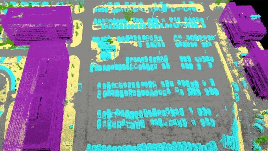
Automatic point cloud classification
Distinguish objects with machine learning classification processes.
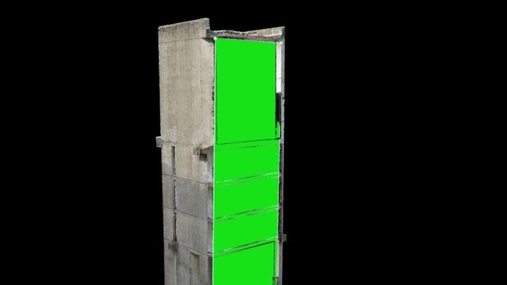
Flatten and smoothen digital surfaces
Create surfaces to improve planarity or fill holes in critical areas.
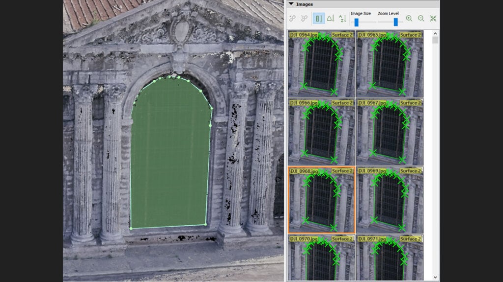
Easily measure surface, distance and volume
Measure features in 3D with a fully-adjustable base height.
Detailed quality report
Assess the accuracy and quality of your projects.
Generate high resolution outputs for any project and use case
Easily export your digital maps and models to industry-compatible formats for further analysis or reporting
Full-color point cloud
.las, .laz, .ply, .xyz
Orthomosaic
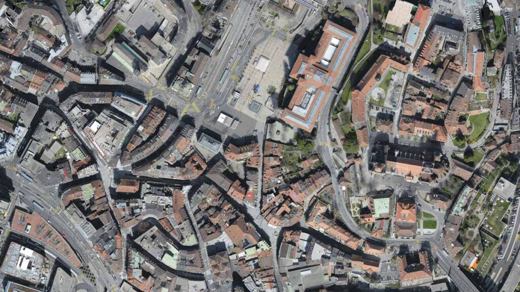
GeoTiff (.tif), .kml
Digital surface model (DSM)
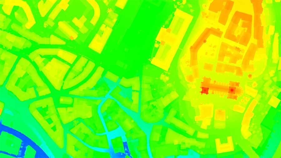
GeoTiff (.tif), .xyz, .las, .laz
3D textured mesh
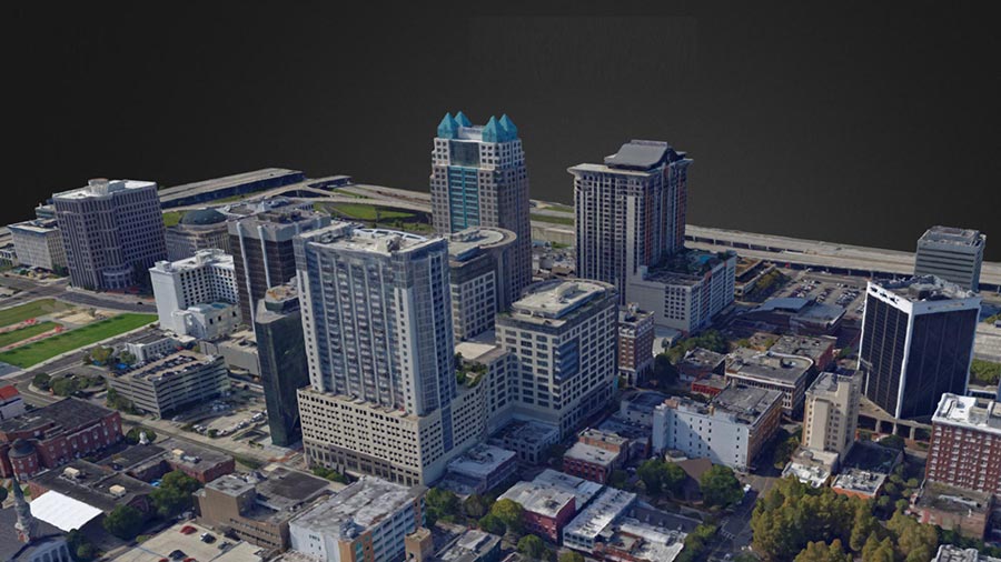
.ply, .fbx, .dxf, .obj, .pdf
Index map
GeoTiff (.tif), .shp
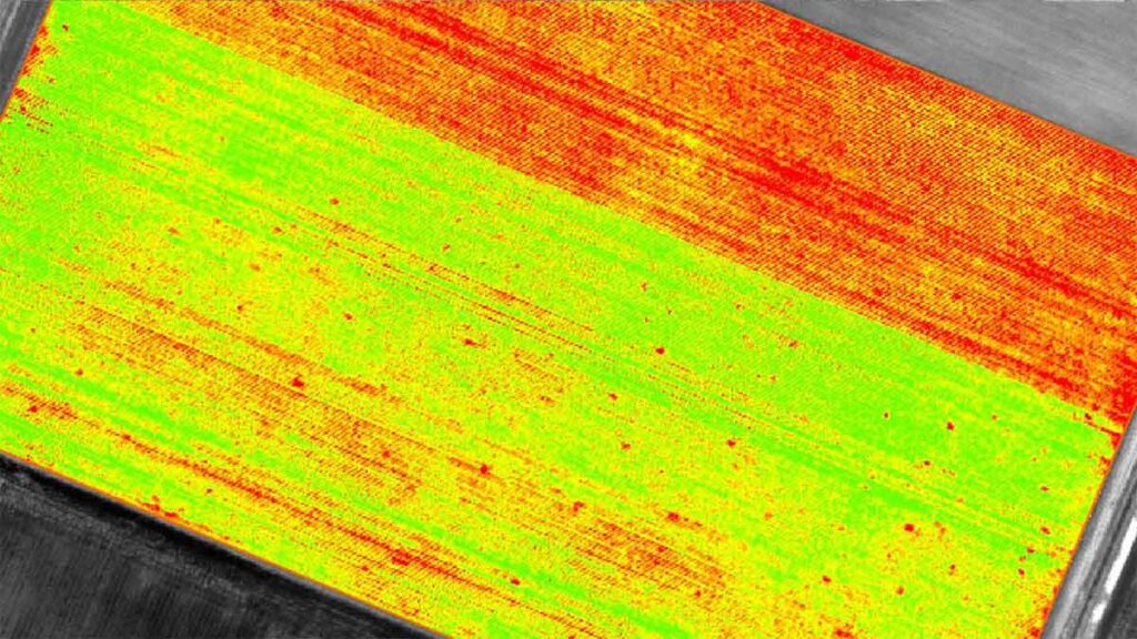
Thermal maps
GeoTiff (.tif)
Recommended system requirements
- Windows 10, 64 bits
- CPU quad-core or hexa-core Intel i9 / Threadripper / Ryzen 9
- GeForce GTX GPU compatible with OpenGL 3.2 and 2 GB RAM
- Small projects (under 100 images at 14 MP): 8 GB RAM, 15 GB SSD free space
- Medium projects (between 100 and 500 images at 14 MP): 16GB RAM, 30 GB SSD free space
- Large projects (over 500- 1000 images at 14 MP): 32 GB RAM, 60 GB SSD free space
- Very Large projects (1000 – 2000 images at 14 MP): 64 GB RAM, 120 GB SSD free space
Resources
Knowledge Base
PIX4Dmapper Brochure
Knowledge Base
PIX4Dmapper Feature List

Knowledge Base
Pix4D Webinars and eBooks
Support
PIX4Dmapper Online Documentation
Software
PIX4Dmapper Download