Description
The mapping software for emergency response
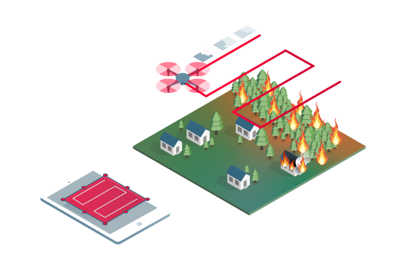
Capture
Fly your drone to capture the images you need. Plan an optimized and automated flight with an app like PIX4Dcapture for DJI drones.
Process
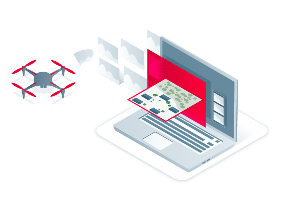
Combine large numbers of images in minutes with PIX4Dreact. Create measurable 2D maps in the field or back at base.

Examine
Identify and measure points of interest, mark and evaluate your maps while on the ground to provide data needed to take action.

Share
Export your maps to ensure teams and decision makers are provided with effective information when it’s needed most.
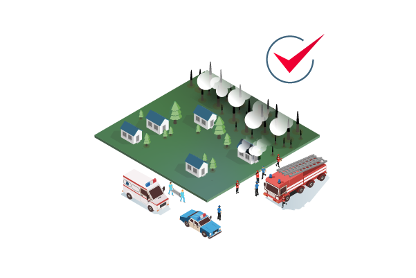
Respond
With up-to-date maps, gain precious time, improve safety and reduce costs when responding to an evolving situation.
In a crisis, every second counts
Get rapid and reliable situational awareness for quick decisions and collaboration in the field.
Fast
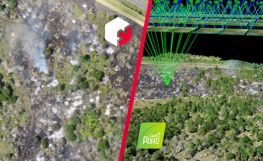
PIX4Dreact creates 2D maps from aerial imagery in minutes. Because when every second counts, up-to-date and reliable information is of utmost importance to teams on the ground.
Easy to use
Simple and intuitive to use, even in complex and stressful situations. PIX4Dreact is developed with public safety and humanitarian aid professionals to meet their unique challenges.
Lightweight and robust
Lightweight enough to work on a mid-range computer in the field. PIX4Dreact doesn’t rely on an internet connection or the cloud for processing.
Share findings
PIX4Dreact outputs can be uploaded to PIX4Dcloud for sharing. Export your maps and reports and seamlessly send them to colleagues or teams on the ground.
Reliable situational awareness in complex situations
Fast and intuitive mapping
Get a fast aerial overview of the scene in minutes without internet. Overlay the US national grid to your maps to make them universally understood.
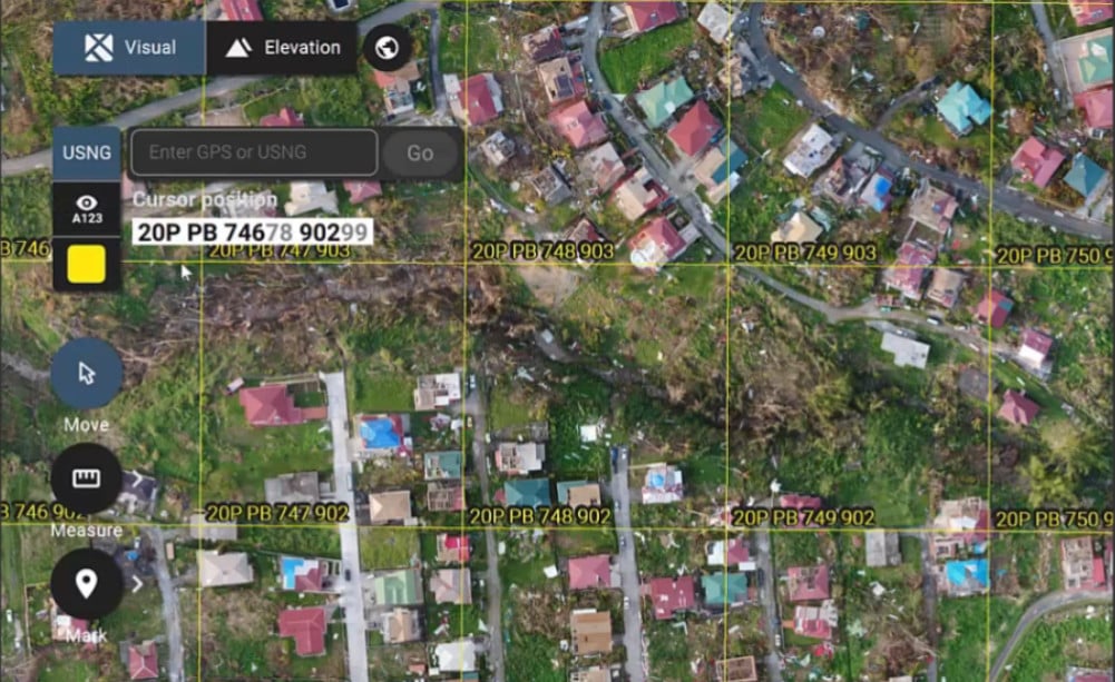
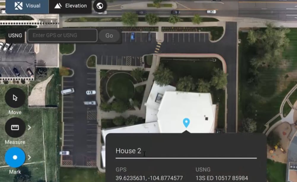
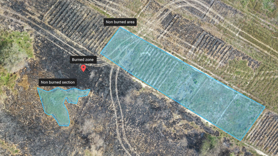
Measure and mark areas of interest
Connect your maps with what you see on the ground. Rely on insights directly from the field and easily mark and measure points of interest.
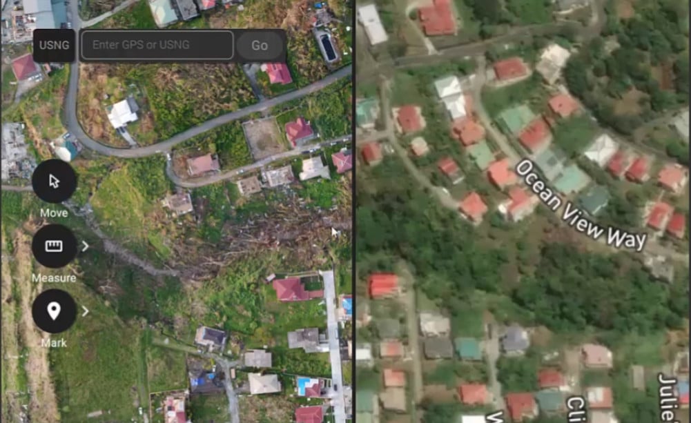
Compare maps
Use a split or swipe view to compare your aerial and elevation maps. Add a standard or a custom base map for an additional level of comparison.
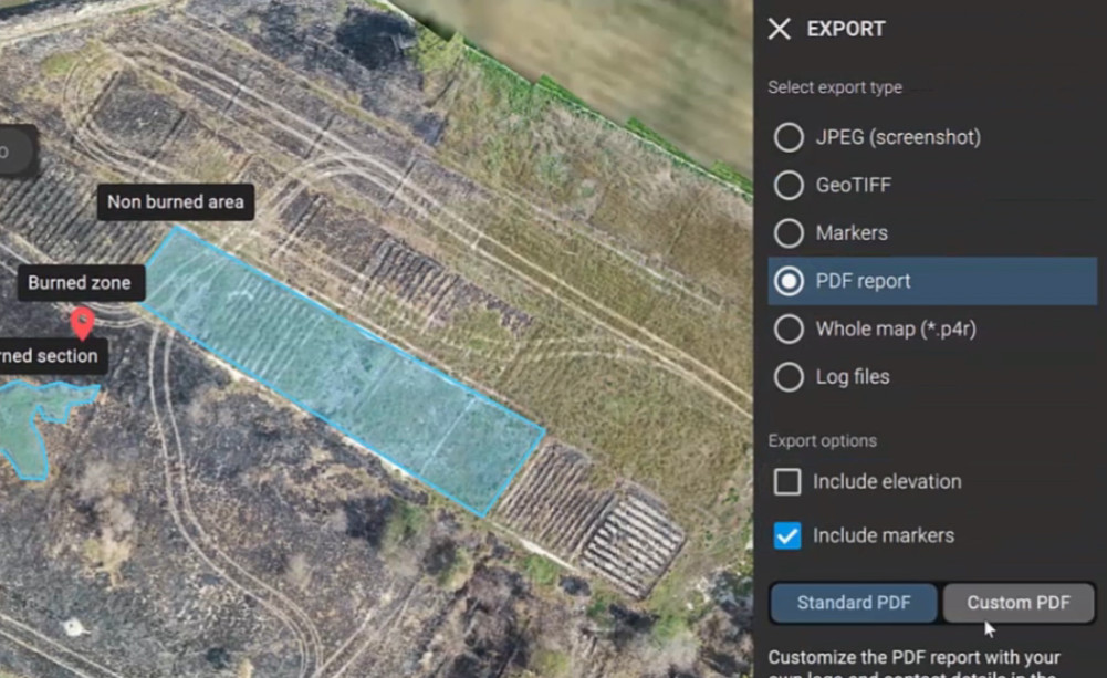
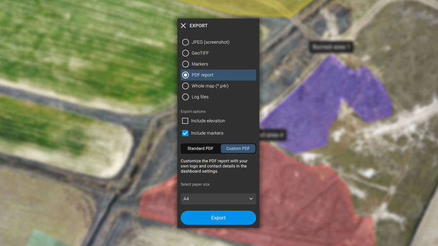
Fast and easy export
Share 2D orthomosaic maps and annotations as a PDF report which are lightweight enough to send over email.
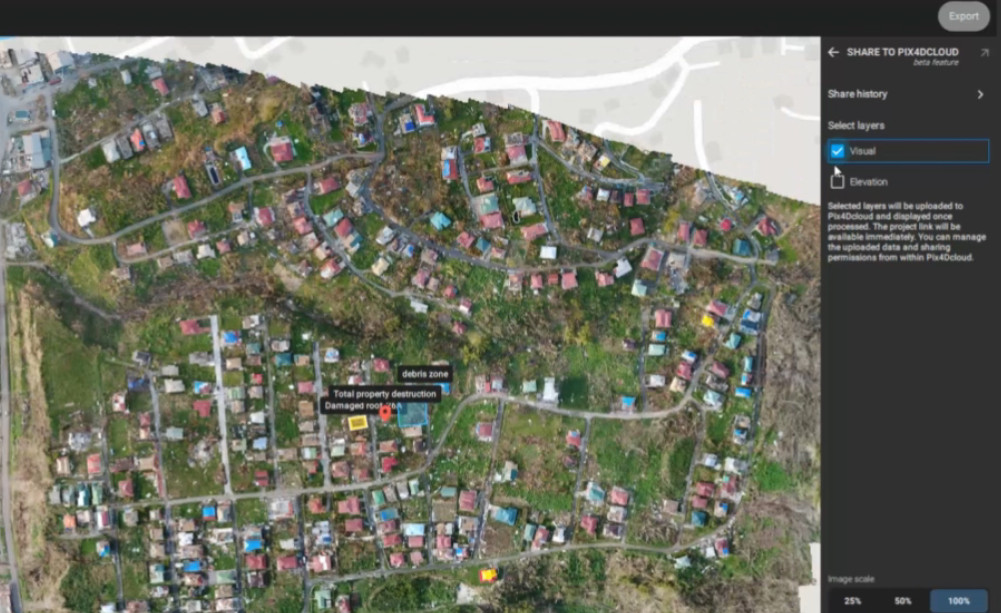
Share to PIX4Dcloud
Upload PIX4Dreact outputs (orthomosaic, surface model) directly to PIX4Dcloud for sharing powerful insights.
Fit for purpose
Use PIX4Dreact as a stand-alone 2D fast-mapping software for emergency response or together with PIX4Dmapper for extra analytical functionality.
The map you need when you need it
Ensure teams and decision makers are provided with timely and effective information needed to take action.
2D orthomosaic map
PIX4Dreact uses fast-stitching technology to create accurate 2D orthomosaic maps by combining a large number of nadir drone images.
geoTIFF
Markers and measurements
Mark areas of interest or GPS coordinates within the project and assess the situation on the ground for collaboration or long-term documentation.
GeoJSON, KML, Shapefile, PDF
Screenshots and whole maps
Document and collaborate in seconds with options to export your maps as screenshots or a whole map that can be imported into PIX4Dreact on another computer.
JPEG
PDF Report
Easily share a 2D orthomosaic, location data and markers in one file over email. Customize the report by white labeling it with your company details and logo.
Recommended system requirements
- Windows 10 (64 Bit) or above, macOS Big Sur (11) or above
- Intel® Core™ i5 or AMD Phenom processor (or faster)
- 8 GB RAM (or more)
- 4GB HDD free space (more for large datasets). SSD recommended
- Integrated or dedicated GPU with 2 GB RAM (GeForce GTX with 6GB RAM or better recommended for faster processing of data)
Resources
Knowledge Base
PIX4Dreact Brochure
Knowledge Base
PIX4Dreact Feature List

Knowledge Base
Pix4D Webinars and eBooks
Support
PIX4Dreact Online Documentation
Software
PIX4Dreact Download