Description

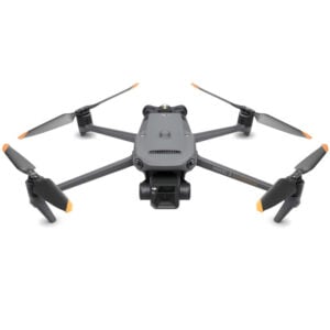
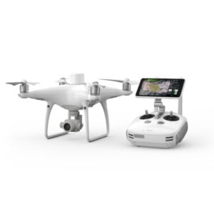
Capture
Capture images or point clouds with a drone or any laser scanner.
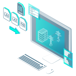
Import
Import data from other Pix4D software or a .las or .laz file to PIX4Dsurvey and combine multiple datasets into the same project. Work with both imagery data and LiDAR point clouds.

Vectorise
Generate a TIN to model the ground and create engineering-ready CAD vector files from point cloud data by extracting key elements of your project with PIX4Dsurvey.

Model
Move from a lightweight point cloud to a model of your terrain. Use the Smart Grid, TIN, and terrain classification to get accurate, actionable results.

Integrate
Open your simplified, accurate data in any CAD or GIS software with custom layers and properties that fit your existing workflow.
Beyond the point
Extract only the most relevant information to speed up and simplify your surveying workflows.
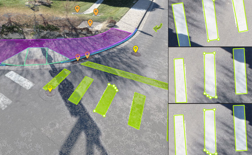
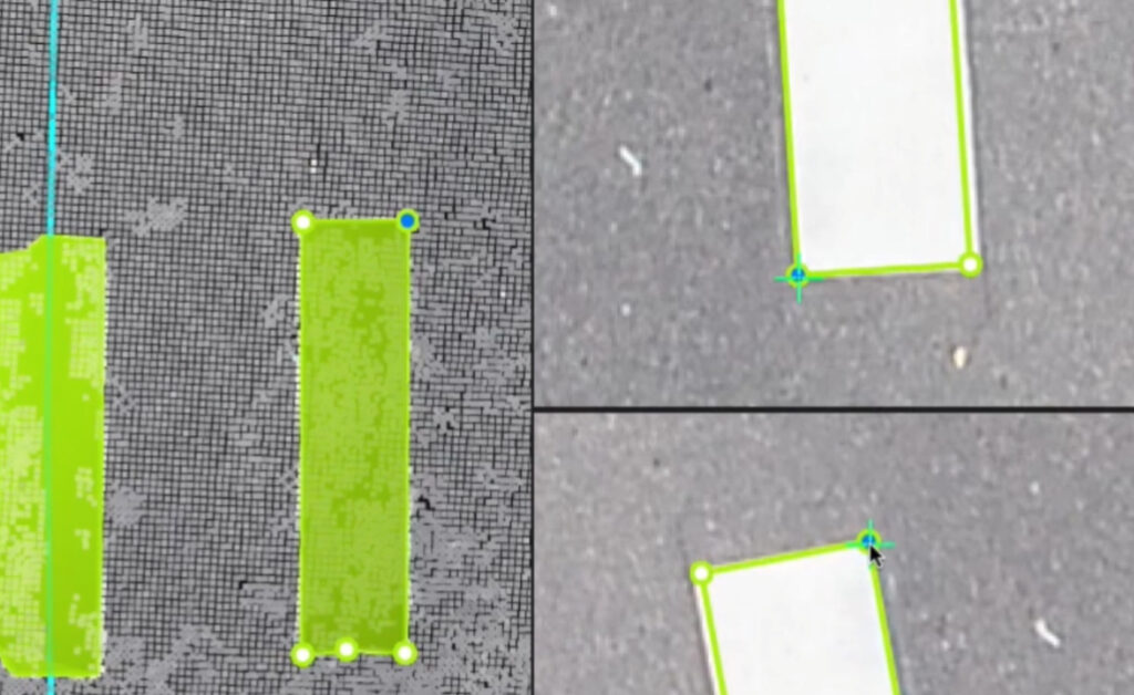
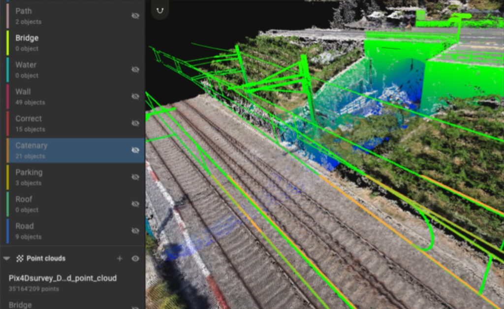
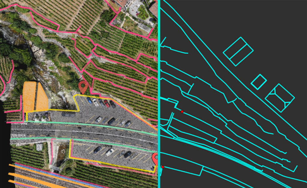
Vectorize anything
Use the combined power of images and point clouds to extract key elements from photogrammetry, laser scanning or LiDAR data. Survey curbs, building footprints, walls, catenary curves and more.
Time-saving benefit
Work 50% faster when you vectorize from point clouds and verify in images, while the Smart Grid saves 1,000s of clicks creating spot elevations.
CAD ready
Include layers and properties for a smooth transition to CAD or GIS and reduce file size when exporting your projects as vector files.
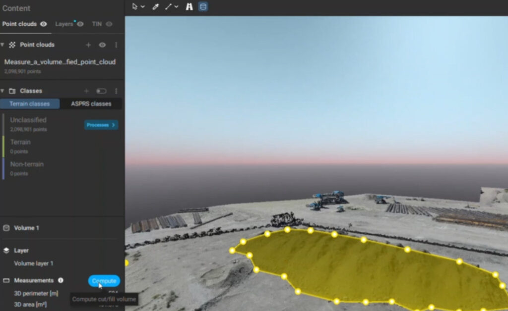
Volume measurements
Create and measure the volume of any object, even against a wall or in a corner, with fast, simple steps.
Extract key elements in 3D
Built-in vectorization tools
Vectorize your project using points, polylines, polygons and catenary curves with just a few clicks.
Measure volumes
PIX4Dsurvey offers intuitive tools for volume calculation of any object or space with straightforward steps.
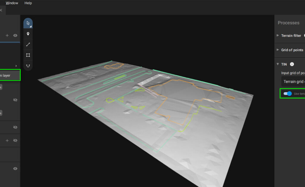
Create surfaces
Model the ground with a TIN from points and breaklines to represent the topography of your project.
Unlock more data
Vectorize in 3D, edit in 2D. Survey complex objects only visible in images. Use colour selection to search for similar points in a defined radius.
Scale up
PIX4Dsurvey can handle billions of points. Work with as many point cloud files as you like in the same projects, including .las.
Easy export
Layers can be exported separately or together for a smooth transition to your preferred CAD or GIS software.
Your choice of point cloud
Import projects from PIX4Dcloud, PIX4Dmatic, PIX4Dmapper or any .las or .laz file.
Aerial data
Create a point cloud from images in PIX4Dcloud, PIX4Dmapper or PIX4Dmatic, and drag and drop the .p4d or .p4m file to PIX4Dsurvey.
Laser scanner or LiDAR
PIX4Dsurvey works with multiple point clouds at the same time formatted as an .las or .laz file.
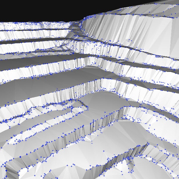
From point cloud to TIN in a fraction of the time
Automate the creation of spot elevations and allow drastic simplification of the number of point cloud points. With a click, use this Grid of points to model the ground with a TIN.
Extract the same points you would use in the field with Smart Grid – it doesn’t create any data, but instead reads the terrain class for locations of elevation change, just like your field crew would take spot elevations along breaklines.
Next up? Take that set of points & breaklines and create a DTM in LandXML format that exactly reflects the points you have told it to use. Now you are good to go in your CAD or GIS!
Recommended system requirements
- Windows 10 (64 Bit) or above, macOS Big Sur (11) or above
- Quad-core or hexa-core Intel i7/i9/Xeon, AMD Threadripper
- 32GB RAM (or more)
- Solid state drive (SSD)
- GeForce GPU compatible with OpenGL 4.1
Resources
Knowledge Base
PIX4Dsurvey Brochure
Knowledge Base
PIX4Dsurvey Feature List

Knowledge Base
Pix4D Webinars and eBooks
Support
PIX4Dsurvey Online Documentation
Software
PIX4Dsurvey Download